Flatey Island, Iceland, 7/4/2023, National Geographic Resolution
Aboard the
National Geographic Resolution
Arctic
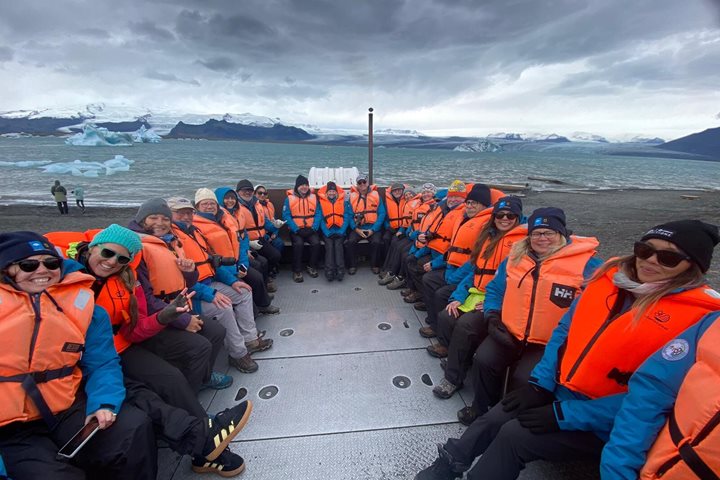
National Geographic Resolution arrived at Flatey Island after navigation from Reykjavik during the night. Following a ‘blue sky’ morning, the afternoon weather became increasingly windy, but that did not prevent an enjoyable visit to the island. Before lunch, guests were treated to a special concert by the Icelandic group Ylja. Ylja played beautiful acoustic and vocal music that told stories of Icelandic history and culture. The group was formed in 2008 by Gigla Skjaldardottir and Bjartey Sveinsdottir.
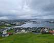
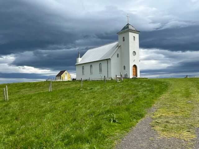
Upon landing on Flatey Island in Skjalfandi Bay, we visited the church and the smallest library in Iceland. The church was originally built in 1897 and was moved in parts using a rowboat to Flatey in 1957. It has been a certified historic building since 2012. Adjacent to the church is the Flatey library, which was built in 1864 and has dimensions of 4.75 meters in length and 3.43 meters in width. It holds approximately 100 books.
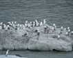
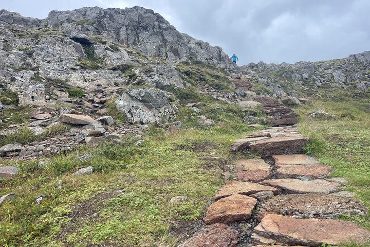
The population of Flatey was largest in 1943 at 120 people. Today, the island is occupied only in summer months by families that own homes in the small settlement. Flatey is an important location for the puffin migration that occurs between May and August. The highest point on Flatey is now named “Puffinsridge.”
Kevin’s adventurist spirit has taken him to many of the world’s special places through work and personal travel. Most recently, he has spent time in the Canadian High Arctic; specifically in Nunavut (Pond Inlet, Arctic Bay, Clyde River and Iqaluit) w...
Enter travel details to receive reports from a single expedition
Loading...
Loading...
Loading...
Send Daily Expedition Reports to friends and family
*By clicking the submit button, I authorize Lindblad Expeditions to email me; however, I am able to unsubscribe at any time. For more details, see our Privacy Policy.
Please note: All Daily Expedition Reports (DERs) are posted Monday-Friday,
during normal business hours. DERs are written onboard the ship only and do
not apply to land-based portions of expeditions.
This morning, we woke up to find National Geographic Explorer cruising the Westman Islands off the southeast coast of Iceland proper. These islands rise straight out of the ocean with towering, vertical cliffs that offer amazing views. With thousands of birds and interesting geology, this archipelago was fun for everyone to explore and photograph. In the afternoon, we went ashore for hiking and panoramic tours of Heimaey. This fishing community was the site of an intense volcanic rift eruption in 1973 that forced residents onto boats, not knowing if their homes would be there when they returned. After five months, residents returned to what was left of the village and began to rebuild. Guests were able to explore this dynamic place by hiking up the volcanic rim or viewing the surroundings via private coach, all affording excellent views and photographic opportunities. Our evening was spent cruising the newest island in the area, Surtsey. This island rose out of the ocean in 1963 and is now a UNESCO World Heritage site. As the sun slowly made its way toward the horizon, we all began to reflect on an amazing expedition around Iceland. Sharing stories with new friends was a great way to spend our last night on board.
Today we woke up to a typical Icelandic summer day: the sky was overcast with high clouds, and the air temperature was soaring around 50 °F. It turned out to be an excellent day to explore Iceland’s East Fjords. We docked in a charming little town called Djupivogur. We had several wonderful excursion options to choose from. Some adventurous guests joined a Super Jeep safari to explore two beautiful waterfalls of the East Fjords: Sneadalsfoss and Einstigsfoss. Others who longed to stretch their legs opted for a 6.5 mile hike to the dramatic and beautiful Black Sand Beach near Djupivogur, a characteristic example of Iceland’s volcanic landscape. The rest of us chose to visit Europe’s largest ice cap by volume, Vatnajökull Glacier. Vatnajökull Glacier is located in the southeast and covers approximately 10% of Iceland. It is a massive and impressive ice cap. Today’s excursion took us to the Jökulsarlon Lagoon, located in the southern part of the ice cap where the melting ice water meets with the ocean. We arrived around midday after a delicious lunch of local Icelandic delicacies. The view was simply breathtaking, and the lagoon was filled with many different shapes and sizes of icebergs. After enjoying the view a bit and taking as many photos as we could, we got into our hybrid boat/truck and ventured into the lagoon itself. What a wonderful and informative boat ride! Our next stop was Black Diamond Beach, where we got the chance to photograph pieces of glassy icebergs on a black sand beach. This is one of Iceland’s iconic photography spots. Tired but happy, we reluctantly bid farewell to this uniquely beautiful place and drove back to National Geographic Explorer . Back on board, we shared our adventures with fellow explorers. After a wonderful Icelandic dinner prepared by Chef Magnus and the galley team, we were invited to the lounge to listen to our on-board band, “Spice Boys.”
We awoke from yesterday’s short-lived-but-officially-polar-adventures at Grimsey to a grim sea of our own, blanketed in misty fog flowing along Iceland’s eastern shores on our way to the storied fjord of Seyðisfjörður. After an educational breakfast and presentations on the wonders of whales by naturalist Kelly and the gallantry of glaciers by expedition leader (and crazed ice cave spelunker) Andreas, we were greeted by the otherworldly scenery of Skálanes. This 1250-hectare, independent natural preserve with its tall cliffs of layered volcanic rock soaring above seabird colonies and diverse plant communities is a working laboratory that helps us understand what “natural” means for Iceland after a millennium of human survival reinterpreting its living landscape. Guided by reserve managers and researchers Óli Pétursson and Rannveig Þorhallsdottir, we ventured through the former pastures and eroded structures—now overtaken by arctic thyme and introduced Alaskan lupine—that supported Icelanders living on this wind-cut edge of the world since the first millennium. As we walked, Oli discussed the need to complicate our ecological thinking when confronted with the errors of land management past, and take a, “Well, we might as well figure out what’s going on,” approach instead of arguing over concepts that exist outside of the existing reality in the soil. He showed us burgeoning birch trees that will someday create a forested Iceland again, a positive for the once extirpated trees and a negative for the many birds that grew quite used to the anthropogenic fields they’ve come to enjoy since the last Viking fires went out. He showed us modern, fast-paced erosion of the pastures that the lupines are meant to fix along with 12,000-year-old glacier-ground gravel as we walked over the remains of huts that would have housed Oli’s grandparents’ generation. We arrived at Rannveig’s dig sites, where she showed us the lived-in-and-on remains of a longhouse occupied since at least 1300, maybe 900 AD. A likely gravesite from the year 1000 was just beyond, and she described how Icelanders still don’t have the full picture of their ancestor’s arrival and settlement of their land. Reykjavik gets to claim many archaeological firsts for Iceland, she mentioned, since there is a city there. People dig all the time and find what was left behind. Here in Skálanes, on the coast most-facing Europe and its seafarers, we don’t know much because we haven’t looked. Those efforts are ultimately undertaken by just Oli and Rannveig. Supported in their work by our visit and patronage, they are slowly uncovering the secrets of the past to help us divine one of the many possible futures for the inhabitants of the land of ice and fire.